
Land of the Warm Springs, Wasco and Paiute Native American Tribes, stretching from the snowcapped summit of the Cascade Mountains to the palisaded cliffs of the Deschutes River in Central Oregon.

Reservation lands extend from the summit of Oregon's Cascade Mountains and snowcapped Mt. Jefferson at 10,497 feet, east to the Deschutes River's elevation at 1,000 feet, with the Metolius River and Lake Billy Chinook forming the
southern boundary.
The dry, high-desert climate of the Warm Springs Reservation differs substantially from the soggy conditions in Western Oregon. The humidity is low, and the sun shines almost every day. Overcast skies are rare. Generally, visitors can expect dry, sunny days and cool nights.
MUSEUM:
The Museum preserves, advances, and shares the knowledge of the cultural, traditional and artistic heritage of the Confederated Tribes of Warm Springs.

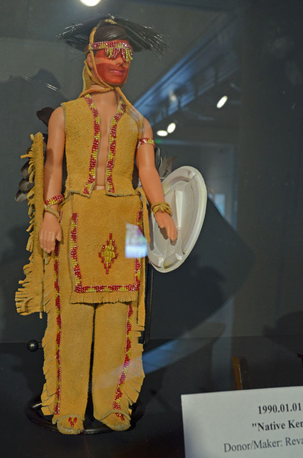
"TREASURES TO MAKE YOU SMILE." April 7 - June 3, 2012
An in house exhibit featuring unique and amusing items from the Museum's Permanent Collection.


Double rainbow over the Kah-Nee-Ta resort


No pot of gold at the end of the rainbow; the casino was moved down to highway few months ago.
Peter Skene Ogden State Scenic Viewpoint
500 foot deep Crooked River Gorge


Three Sisters
are three volcanic peaks of the Cascade Volcanic Arc and Cascade Range, each of which exceeds 10,000 ft (3,048m) in elevation. They are the third, fourth and fifth highest peaks in Oregon.

The three peaks have 15 named glaciers among them, nearly half of all the 35 named glaciers in Oregon. The Sisters were named Faith, Hope, and Charity by early settlers, but "these names have not prevailed.
SMITH ROCK STATE PARK
The dramatic appearance of the park area is a testament to the cumulative force of vulcanism and the erosive power of running water. Millions of years ago this area was a major center of volcanic activity. After a period of localized eruptions, lava flows entered the canyon and crowded the ancestral river into the flanks of the main volcanic structure. Forced to establish a new channel, the Crooked River eventually eroded the interior of the volcanic vent. The wondrous and multicolored formations are composed of rock known as “welded tuff ”—volcanic ash erupted under conditions of extreme heat and pressure.
There are several thousand climbs in the park. More than a thousand are bolted
routes. It also offers miles of hiking and mountain biking trails.


MISERY
Went for a hike up and around to the other side, then had to come down also. Both sides were very steep and quite slippery; loose gravel.


NOTE:most difficult?

second zic zac and still more to come around the corner.


just in case

Finally heading down. Nice walk on the riverbank
and huckleberry ice cream before dinner.
I survived.
No comments:
Post a Comment